Thursday, February 28, 2019

Paragliding from Snoqualmie Mountain

On February 2nd I flew from Snoqualmie Mountain's east summit and landed on Snow Lake. I had been thinking about paragliding off Snoqualmie for a while. I've spoken to a couple other pilots who have flown off the summit to the south and landed at the Alpental ski resort in the summer, but I thought it would be better to fly around the more scenic north aspects of the mountain to land on Snow Lake to the west. This way I could also avoid a potentially dangerous (and probably illegal) landing at the ski resort during their operating hours.


Overview of my flight in Google Earth

It was a relaxed Saturday morning and I slept in a bit. I had no real plans for the day since the weather was looking mediocre, and I'd already had a lot of hike & fly adventures the previous week. It was looking foggy outside and Tiger mountain was also completely socked in on the webcam. 

However, a quick look at the Summit at Snoqualmie skiing webcams showed clear and sunny conditions at the pass. With winds from the north at just 5 mph conditions were looking excellent for my imagined flight off Snoqualmie mountain. Avalanche conditions were still low to moderate, so I felt comfortable going solo.

Excitedly I packed up my gear and had a late pancake breakfast before zipping up I-90 to the main Alpental parking lot. I starting skinning just before 11am with a goal to take off by around 3pm. 


Halfway up Snoqualmie with Guye peak in the background

The skinning was very slow low down in the trees with super icy conditions (ski crampons required)  and some steep sections that I needed to boot, but once I gained enough elevation to traverse to the south ridge the traveling became much more enjoyable. I was familiar with the route as I had done it once before to ski the Slot and Crooked couloirs on Snoqualmie's north face with Lane. For a GPS track of my climb click here.


Looking south at Guye peak and the Alpental ski resort


Views of Red Mountain to the east


Looking up the south ridge to Snoqualmie's summit


The only tracks on the mountain

After summiting at 2pm I scouted out north-facing launch options, but couldn't find any areas free of trees near the ridge. I considered dropping down into the Crooked Couloir slightly, but the north-facing slopes seemed to be wind loaded quite a bit and I didn't feel like dying in an avalanche.


Looking into the Crooked Couloir from the summit ridge

The east summit looked to be the best option with a nice rounded top and plenty of space for a northwest-facing launch. I decided to traverse south under the steep ridge instead of exposing myself to wind slabs on the north side. The south slopes were getting blasted by the sun, and I set off a couple small wet slides as I kick turned my way down the steepest sections. I wasn't concerned as the run-out was safe and the slides were easily predictable.


View of the steep ridge and east summit beyond


The east summit of Snoqualmie

My first couple launch attempts were aborted. At first I tried launching with the skins still on my skis (which had worked for me on my previous two ski launches), but the snow conditions were quite sticky and I wasn't able to pick up enough speed. My second launch attempt failed because I was facing too far west, and the north wind picked up one side of my wing first and flipped it over.

After some frustration and stumbling around in the snow, I finally got things figured out and had a successful cross-slope takeoff at just after 4pm. You can see a full track of my flight here. Below is a video from the flight. I also have a full flight video on my YouTube channel if you've got 10 minutes to spare.


Video highlights from the flight


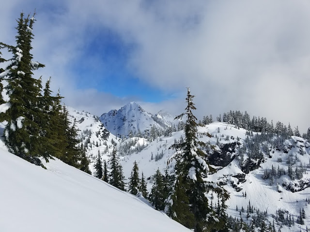
The flight was incredible with nice sunset lighting as a result of my launch delays. The views looking at the Slot Couloir and steep cliffs on Snoqualmie's north side were amazing. I took advantage of the light north wind to gain some lift off the ridge as I glided to the west towards Snow Lake.  It was fun to fly close to the knife-edge and have views looking over the south side into the Alpental valley. I was eyeing bailout options just in case something went wrong, but thankfully the flight went smoothly and I had plenty of altitude to make the lake landing.

After packing up my wing I had a short skin out to the divide above Snow lake, and some spicy skiing on very firm snow back out to the car -- arriving just as it got dark.


Skinning out from Snow Lake


Skiing back out the Alpental valley (Snoqualmie mountain on the left)

Thursday, February 14, 2019

Flying off Mount Baker

Flying from the summit of Mount Baker (1/29/19)
Picture: Travis King

Mount Baker is probably my favorite volcano in Washington. At an elevation of 10,781 feet, it's the 3rd highest mountain in the state. In May of 2015 I first climbed Baker as part of a UW climbing club trip, and on that trip I met several good friends who I still climb with often.


Shirtless summit picture from my first Baker climb
(May, 2015)

In April of 2018 I climbed Baker for a second time, but this time in one day with backcountry skis. Skiing from the summit was one of the most adventurous things I've done, and was my longest ski descent at the time of 8,000 feet. Click here for a gps track from that ski trip.


Skiing the Coleman Deming Route in a day


A month later in May of 2018 I climbed Baker again via the more technical North Ridge in a day with Lane Aasen. We carried our skis up and skied down the Coleman Deming route. That was an incredible trip, and probably the most fun day I've ever had out on a volcano. Lane wrote up a full report from that trip, you can read it here.


Lane climbing up the North Ridge of Baker
(5/26/18)

Now I can say I've also flown off the mountain with a paraglider! 

On Sunday night Lane messaged me asking if I wanted to skip work Tuesday to ski or climb/fly off Baker or Eldorado Peak. This was just at the end of a weekend where I had already flown off Saint Helens and the cliffs above Snow Lake. I was a couple beers in at the time, so mentioned that I was interested and would do some more planning on Monday.

The weather forecast looked very nice on Baker with light winds and no clouds on Tuesday. I was psyched on continuing my mountain-flying streak, and managed to convince Travis to skip work and join me for a one-day trip on his new AT skis. 

Lane got off work earlier, so he decided to drive up Monday evening to get a full night's rest at the trailhead with the intention of starting his climb a couple hours after us. I decided not to bring skis based on a trip report from a few days earlier that described firm snow conditions. My paragliding pack was already going to weigh ~35 pounds, and I didn't like the idea of carrying an additional 10 lbs of skis up the Roman Wall plus dealing with the added complication during launch. 

After swinging by Chop Express to grab some Vietnamese burritos for the following day we got home and started packing. I got to sleep around 10pm, and woke up at 2am to start the drive north. We drove as far as possible on the forest road until snow stopped us 1.3 miles short of the trailhead. I saw Lane parked and regretted not bringing some Smirnoff's to ice him with. 

Travis and I started hiking just before 5am. There was very treacherous ice on most of the approach trail, and Travis was forced to carry his skis for the first few miles. At 7am we came to the main snowfield below the hogsback, and I unfortunately started sinking into the snow with every step. 

Travis skiing up the hogsback just above treeline

At this point I really wished I had skis or snowshoes to prevent my post-holing. I was still able to maintain a decent pace, but slower than Travis on his skis. At one point I decided to cut up a steeper slope to take a more direct path and hopefully avoid the deep snow, but two-thirds of the way up I realized I was on the leeward side of a ridge. I dug a quick snow pit and discovered a wind slab that could slide easily when loaded. Feeling sketched out and extremely dumb about my mistake, I carefully climbed up the remainder of the slope until it flattened out into safe terrain.

Avalanche danger was low on the NWAC forecast, but that doesn't necessarily apply to the much higher elevation volcanoes that have colder temperatures and higher winds. Plus when booting up slopes it's much easier to forget how steep the slope is compared to when you're making a skin track. I'm glad I can learn from that mistake.

First views of Baker above treeline
Photo: Travis King

Travis and I continued up the Coleman Deming route at an approximate 1000 ft/hr pace. I was working hard with every step and really wishing that I had brought small snowshoes or anything to float better on the snow. There were some sections where I could float on top of old skin tracks and keep pace with Travis, but as soon as I started sinking he would pull ahead.

Travis skinning with Colfax on the right and Baker left

By 11am we had made it to the gap at 9000 feet, just below the steep section known as the Roman Wall. This is where Lane caught up to us and we chatted shortly before he continued upward.  I was tired and needed a lunch break, so we hung out in the sun for a half hour to chill and eat.


Lunch break at the gap below the Roman Wall
Picture: Travis King
Lane passing us and continuing up the Roman Wall
Picture: Travis

The climb up the Roman Wall is usually where you start to notice the altitude, and we did feel ourselves slowing down during the last 1500 feet of steep climbing. There were a couple of fighter jets flying around the mountain to provide us with entertainment, and we also saw what looked to be a rescue helicopter practice a landing on Colfax peak.


Helicopter landing on Colfax Peak
Photo: Travis

Towards the top of the Roman wall we met Lane as he was skiing down, I guess he was going for speed and didn't feel like waiting around for us to meet him up on the summit.

Lane skiing down the Roman Wall for his 3rd time
Photo: Travis
Having a brief chat with Lane
Photo: Travis
Climbing up the last section of the Roman Wall
Photo: Travis

We summited ahead of schedule at just after 1pm. For a full GPS track of our climb click here. The wind seemed calm and slightly north. After enjoying the summit for a few minutes I climbed down slightly and began unpacking my wing.

Sorting out my lines before launch
Photo: Travis

I aborted my first launch attempts when my lines got caught on pieces of protruding ice. Even after untangling my lines from the ice I realized that I was too far upslope and experiencing turbulence as the wind separated from the slope. The wind gradient was quite strong, and although wind speeds were only 5 mph near the ground, just 20 feet up it seemed to be much stronger.

Struggling with the wing in turbulence
Photo: Travis

After the aborted launches I bunched up my wing and moved further downslope to a section of smoother snow where it was less likely for my lines to get caught on the ice. The air was smoother there, and I was able to successfully launch after Travis helped unfold my wing. If you've read this far, you probably deserve to see a video of the flight, so here ya go:


Video from the flight
  

Launching to the north
Photo: Travis

Looking back shortly after launch
Photo: Travis
Disappearing below the summit
Photo: Travis 


I was originally hoping to fly south of Colfax and Lincoln peak before cutting back to the north, but after my difficulty on the launch I decided to play it safe and stay on the north side of the ridges to stay upwind and avoid potential turbulence. I enjoyed amazing views of the north face of Baker including the North Ridge as I traversed around the mountain to the west.

Lower down on the glacier I played around near some huge crevasses and seracs. It was cool flying close to the slope. If I felt too low I could easily turn sharper down the slope and regain height above the ground.


Follow-cam picture as I fly around Baker's north face

Views of the Roman Wall and Colfax as I glide to the west

Flying near seracs low on the Coleman Glacier

I landed next to the hogsback just above treeline. Travis and I had radios, so I notified him as soon as I landed safely. I packed up my wing and enjoyed a burrito as I waited for Travis to ski down. For a full GPS track of my flight click here.

Travis took a while to ski down and I was getting a bit anxious. It was relieving to finally see him show up on the horizon. We met up and hiked out to the car arriving just before 5pm. After helping pull a truck out from the side of the icy road we had a good drive back to Seattle with the aid of a Red Bull, getting home by 9pm.


Saturday, February 9, 2019

Paragliding to Snow Lake

Snow lake, an extremely popular hike in the summer, is surrounded by some of the most impressive and easily accessed backcountry skiing terrain in the winter. With the trailhead at the Alpental ski resort only a 40 minute drive from my house, I've spent many winter weekends exploring the area on skis with friends.

Ski touring in the Alpental Backcountry, November 2017

On Sunday January 27th the weather was looking very nice for paragliding in the mountains. Just the day before I had flown off Saint Helens (see my last post for details), so I slept in and had a relaxed morning. The skiing conditions were still quite poor, with no new snow and a lot of icy slopes. After checking the weather and seeing that it was sunny with light north winds at Snoqualmie pass, I knew I would regret it if I didn't get up there and fly off something. As my climbing and skiing friends often say, you gotta go for the "full value weekend". 

The slopes to the south of Snow lake are mostly free of trees and have interesting rolling features, but terminate in huge 400 foot cliffs that drop directly to the lake. The past few years while skiing in the area I always thought it would be epic to ski down the slope and just fly off those cliffs with a paraglider to gracefully land on the frozen lake below. With my new paraglider, good weather, and stoke at an all-time high it seemed like this was the time to make that happen. 


The beautiful views above Snow Lake
(April 2nd, 2018)

The cliffs south of Snow lake with Chair peak beyond (note the skiers for scale)
(December 9th, 2017)

After eating brunch and packing up all my gear, I was on the road before noon and got to the trailhead around 12:30. The ski resort was super packed and at first I was concerned about finding a parking spot. I don't think I've ever seen so many people parked in the Alpental north lot (although I'm normally skiing by 8 or 9am and back around sunset). I found a spot without issue and quickly began the ski towards Source lake. I felt surprisingly good despite climbing Saint Helens the day before -- all those hike & fly laps up Tiger Mountain have been paying off with increased fitness. 

I wouldn't normally ski the Alpental backcountry without partners or avalanche gear, but the avy danger was low on most terrain and I was extremely familiar with the route, so I decided to forgo the avalanche equipment. In hindsight I really should have brought just my beacon as it's light and worth bringing even in low danger. 

The ski was nice and it felt good to be in the sun above the low clouds that were immersing Seattle. As I approached the basin below Chair Peak (seen in the 1st photo), I felt winds coming up the slope and was thinking about changing plans to launch from higher up in the basin and flying over a shallow section of the ridge to get down to Snow Lake. However, as I went further up the basin and into the shade I felt catabatic winds coming down the slope and decided it would be a bad idea. Sticking with my original plan I went back down the basin slightly and booted a steep section to the ridge south of Snow Lake to top out at 2:20. See my full gps track here.

The winds were from the north, but a bit stronger than I had expected on top of the ridge at maybe 10 or 15 mph. I pulled out my wing and began to setup for launch, but was sketched out thinking that my wing could easily get blown over the other side of the ridge. I decided to move a bit further east where there was a shallow depression to shelter my glider from the wind as I unfolded it. The winds and steep slope necessitated a reverse launch, and since it was icy I decided to leave the skins on my skis so I wouldn't easily slide backwards during the launch. After giving the A-lines a couple good yanks the leading edge caught the wind and my wing inflated well. It wasn't the most beautiful reverse launch ever, but I felt good enough about it to turn around and quickly ski/fly off the steep slope. Here is the full video of my flight:

Full paragliding flight down to Snow Lake

I had hoped to get some lift to soar the ridge, but dropped away and quickly bailed on trying to gain the ridge again. The flight went really well, and it was cool to fly next to those huge cliffs I had spent so many days looking at previously. Click here for the full GPS flight track. After a smooth landing I packed the wing up, skinned back up 500 feet to the exit from Snow lake, and survival-skied 3 miles out to the Alpental parking lot on icy south facing slopes.


Tuesday, February 5, 2019

Flying off Mount Saint Helens


On Saturday January 26th I had the incredible experience of paragliding from the summit of Mount Saint Helens. I'll start off this post by sharing a video from the flight. I am the one with skis on and the gold wing.


Paragliding descent of Saint Helens (1-26-19)

When I started researching paragliding mountain descents this past fall I decided that Saint Helens would be a good choice as one of my first mountain flights. The Worm Flows climbing route up the South face is very straightforward and I had done it previously during a Boy Scout trip back in August of 2013. As part of that trip we also spent several days circumnavigating the mountain on the Loowit trail. It was cool to see all the different ecosystems around the mountain ranging from old growth forests on the south side to the desolate pumice and ash plains to the north. The scout troop was featured in the Boy's life magazine as part of that trip. 


Video feature from Boy's Life Magazine

If you aren’t very familiar with the Saint Helens eruption, you should spend an hour and check out some videos or pictures online. I find myself spending several hours watching documentaries or reading about details from the eruption at least a couple times per year. Here is another video to get you started down that rabbit hole if you choose to jump in.


Sorry for getting a bit off topic, let's get back to the paragliding thing. I'd like to give credit to the Washington Hike & Fly Paragliding YouTube channel, as that is where I got the inspiration for my flight. Weather was looking very nice in the mountains during the weekend of Jan 26-27th, and the skiing conditions were quite icy because of a period of dry and warm weather in the Cascades. During work on Friday I kept checking the weather and saw that sun and light north winds were forecasted at Saint Helens. Even though south winds would have been preferable because of the south-facing takeoff, I decided it would be worth a shot figuring that conditions would be quite calm and in worst-case scenario I would at least get to ski down. 

I was prepared to go solo, but thought it would be better to fly with someone else for the added stoke and safety. I had met Greg while flying at Tiger and Saddle mountain, and decided to invite him along because I knew he had some mountaineering practice and was a more experienced pilot than me. Luckily Greg was up for it despite less than a day's notice.

The plan was to leave from my place in Eastgate at 4am and pick up Greg in Tacoma along the way. I had a difficult time sleeping because of my excitement, and remember doing a lot of dreaming/visualization on how I wanted the next day to go. After getting a late start in the morning because of an accidental snooze-shutoff on my alarm, I was on the road by 4:45. After picking up Greg we blasted down I-5 and arrived at the Marble Mountain Sno-Park before 8:30 and started hiking at 8:50. See my full GPS track of the ascent here.


Looking South towards Mt. Hood as we climbed above treeline

With nearly 6000 feet of elevation gain in 7 miles, the Worm Flows route is fairly direct. We scouted out a landing zone adjacent to the approach trail, but were disappointed with how small it was and by the fact that there was no snow on the ground for my ski-landing. We decided it would be better to land at an alternate spot further from the parking lot which I had scouted out on Google Earth. It was fun to chat with a bunch of other backcountry skiers on the way up. I knew we would look a bit conspicuous with the huge backpacks, but was still surprised by how many people approached and were psyched as we explained our hopeful plans to fly from the top. 


Chatting with a skier during the ascent.
Photo Credit: Greg Overton

Greg half way up his first mountain climb in Washington

It felt like spring on the mountain, with actual corn snow that had developed during the past week. I was in full beach-mode wearing a T-shirt and repeatedly slathering sunscreen on my face and arms. The last 2000 feet were quite icy, and I was glad to have my dynafit ski crampons with me. Greg was a bit slower without a ski setup, but we maintained a steady pace and made it to the crater rim by 2:00.


Panorama looking north into the crater
Photo Credit: Greg Overton

Although most everyone else was hanging out at the top of the route, we wanted to tag the summit and traversed below the ridge westward across some really gnarly windblown ice and sastrugi. In spots I had to take off the skis and boot through some of the worst ice. 


Greg beginning the traverse towards the summit
Booting through sections of windblown ice
Photo Credit: Greg Overton
A gap on the traverse with views of Mt. Rainier

After tagging the summit we thought about our launching options. Winds directly at the crater rim were probably at 5-10 mph from the north, but even slightly down-slope there was almost no wind, and at times some slight breezes from the west. We decided to down-climb about 100 feet to a gradual southwest-facing slope where there was some nice clean snow. 

We setup our wings for a forward launch and felt good about the conditions. The sky had turned slightly cloudy to the southwest and a beautiful sunset display was beginning. I had never done a ski launch before, but it turned out to be quite simple and I was able to execute it well enough. Because the snow was firm I decided to leave my skins on as I was confident I could still pick up enough speed while maintaining better control.

I took off first at 3:50 and Greg followed just after. The flight was everything I hoped it could be. The views of Helens, Adams, Rainier, and Hood were amazing. Although I didn't catch any lift, there was plenty of altitude to play around and take everything in without stressing about making it to the landing zone. Here is a full GPS track of my flight path.


Greg packing up his gear in the LZ after an epic flight


After packing up we took what was in hindsight a really dumb route back to the car which consisted of bushwhacking and crossing the same stream twice unnecessarily. I don't think I've ever done a worse job of navigating before, but we were both so pumped up from the flight that we didn't care about our soaking wet boots as we walked the last half mile to the sno-park. GPS track here.


Sunday, February 3, 2019

Starting my Paragliding Journey


It's February 3rd and the past week has been filled with incredible paragliding mountain descents from Saint Helens, Mt. Baker, and Snoqualmie Peak. I feel like I should write up reports of these trips to remember them clearly and reflect on them, but first I think an introduction is necessary to establish how I got to this point.

Paragliding has been in the back of my mind ever since my early teens when I first discovered that it was a thing. It appealed to me as the simplest and most affordable way to fly, without needing official licences or several years of training. After gaining competence in rock climbing, mountaineering, and backcountry skiing throughout my college years, I thought paragliding would be an amazing way to descend from mountain peaks and continue to explore the wilderness of Washington.

When I was in middle school I unknowingly started my paragliding training by flying power kites. It was fun to get tossed around by my 4 square meter Beamer III kite, and in strong conditions I could catch quite a bit of air. Power kites are essentially mini paragliders, but with much longer lines and a different control setup. After buying my power kite I also discovered the original GoPro Hero 1 and was probably one of the first people to buy one. Below is a funny throwback video to my kiting days.

Power Kiting on vacation at Huntington Beach (2010)

My GoPro power kite edit from 2010

After moving to Seattle for college I did some research on paragliding and discovered there was a school at Tiger mountain less than a half hour from Seattle. Unfortunately during college I was too busy and way too poor to start paragliding. Finally, after graduating with my ME degree, working for almost a year, and conveniently moving to Eastgate (only 15 minutes away from the paragliding school), I figured it was time to jump into it. 

My first day of paragliding training was on September 3rd, 2018 and consisted of signing lots of waivers before going on 3 tandem flights from the Tiger mountain launch, followed by my first two solo flights. I was surprised that it was legal to get thrown off a 2000 ft. mountain with less than a full day's worth of training, but felt confident enough in my abilities to get down safely. Basic paragliding controls are quite simple: pull on either brake toggle to turn left or right, both brakes to slow down/stall, and use weight shift (leaning into turns) to accentuate your movements in flight. If you've got a few extra minutes check out this video from my first flights:


Video from my first solo flights

For my first flights my helmet was equipped with a radio so that I could be directed on my landing approach by instructors. Takeoff and landing are the two most dangerous and skill-dependent parts of paragliding. During the next few weeks I got out to Tiger mountain as much as I could, and after 10 or so flights I was quite confident with my skills and no longer needed help with my takeoff or landings. It was around this time in late October that I bought my own paragliding gear and decided to update my Gopro 1 to the new GoPro 7. My new Nova Ion 5 glider performed much better than the old student wings I had been training on, and my Advance Progress 3 harness becomes a backpack when turned inside out which makes the 1600 ft. of elevation gain on the hike quite a bit nicer. 


Setting up for a launch from Tiger Mountain with my new gear


Gaining confidence at Tiger Mountain


The 2018 fall had much nicer weather than average, and I was lucky to get in lots of flights on the weekends and a few in the evenings on work days. For my 22nd and 23rd flights I took a solo trip out to Leavenworth and flew off of Tumwater mountain. I had done a lot of research online beforehand, and only felt confident enough to fly at a different site because of very stagnant air conditions. It was amazing to fly over Tumwater canyon overlooking the mountain town of Leavenworth where I had done some of my first hikes and rock climbs in the Cascades. See video:

Flying from Tumwater Mountain

I was definitely hooked on paragliding by now, and got up to 25 solo flights before the end of 2018. With 25 flights I received my P2 rating, which allows me to fly at many other designated paragliding sites without supervision.